This 8-ish mile out-and-back hike was the prefect way to spend the day. From hiking, to fishing or swimming, this hike offers fun for the entire family! I completed this hike with my parents and 3 dogs and had a blast.
We went in April of 2023. At that time, there was not a lot of shade from trees yet so it got pretty toasty in some places. Also, since it was dry, most of the natural springs weren’t flowing. If you are bringing pets, I’d suggest packing extra water for them as the springs proved unreliable for us. Luckily we had packed just enough and could refill our bottles at the springs at the top of the mountain. I’m sure the streams can be different in different seasons and weather trends, but I would bring extra water for pets regardless just to be safe!
You may access this hike from Beulah Road outside of Bemus, WV. Parking is not in an established lot, but in gravel pull-offs along the edge of the road. When we went on a Saturday in April, we were the only hikers on the trail. The trail head is marked by a wooden sign with yellow lettering.
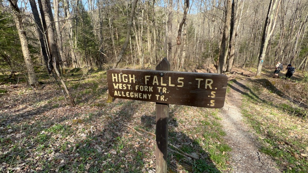
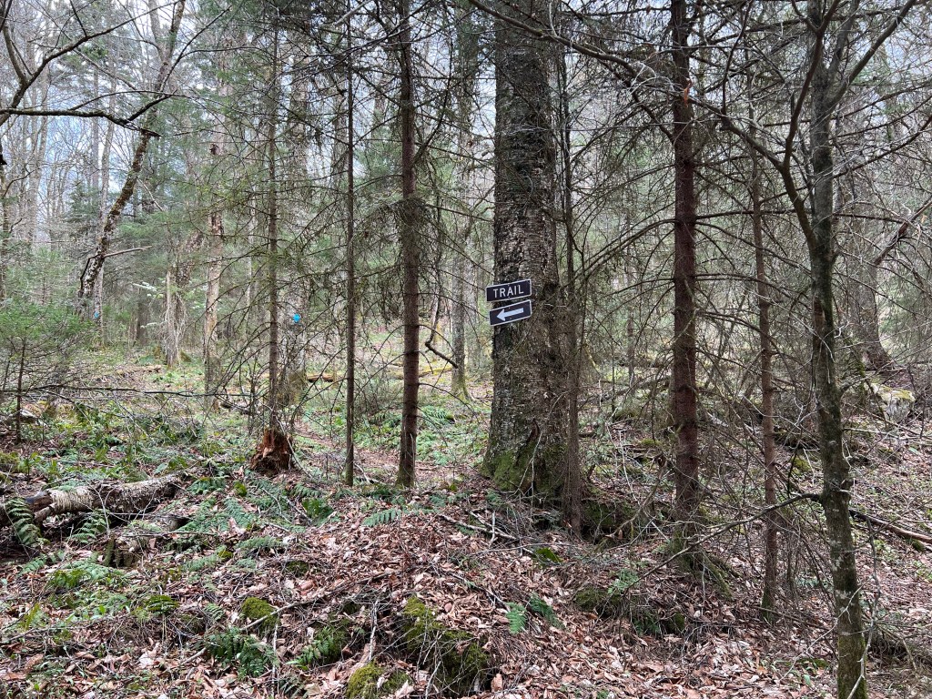
The trail starts off slightly graveled before turning to dirt. After the first bridged stream crossing, you will enter a field where wildlife reclamation is taking place. Continue past the gravel road and up the path leading into the tree line. From there, you will follow switchbacks to the top of the mountain where the Allegheny Trail splits from the High Falls trail. The trails in this area are marked with blaze and have good signage near intersections. As always, having a digital and paper map are helpful when hiking.

As I noted before, the small streams that appeared to be present in other seasons were dried up in the Spring. However, in other seasons they may be present so wear proper footwear for muddy trails.
At the top of the mountain, there are a few camp sites for backpackers with campfire rings already in place. Please be cautious of current weather conditions and burn bans should you choose to create a campfire.
After crossing the peak of the hike, the ecosystem changes to dense pines with a rocky, rooty trail. As the trail begins to slope downwards, it connects with an old rail grade.
Follow the blaze to take a right at this intersection to follow the grade along a small stream until you reach a rock carin. At this point, the rail grade continues straight. However, you will want to follow the High Falls Trail blaze down to the left to continue descending the mountain.
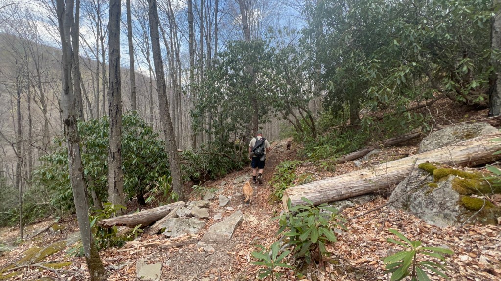
This section of the trail was again, exposed in the Spring, with a rocky path. Taking switchbacks down the mountain and following the blaze will lead you to the train tracks. At this intersection, turn right again. Then follow the tracks until you reach the first large bend in the tracks and river. Along the way, there are a few areas with paths down to the river you may noice.
Notice: These tracks are still in use by the New Tygart Flyer tours so please walk on the trail to the side of the tracks and not directly in the tracks.
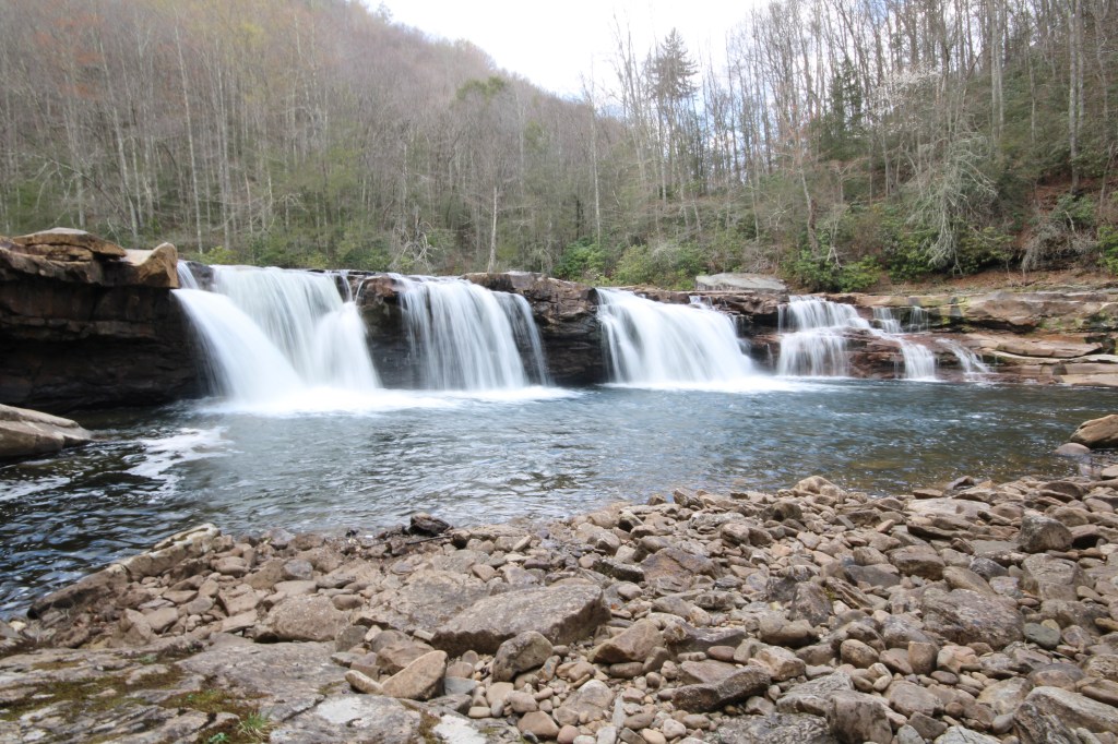
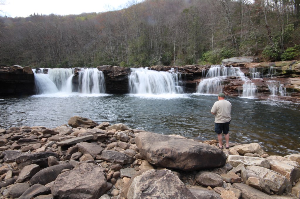
However, the actual high falls is impossible to miss if you walk far enough. At this bend, you will hear the high falls as well as see a train stop, picnic tables, and drop toilets. This is where the New River Tygart tours drop off tourists. Although this tour is only offered seasonly, it is worth looking at their schedule if you want the place to yourself.

The high falls span the width of the river and offer a sweet swimming spot. This area is also stocked seasonally with trout which makes for wonderful fishing if you watch the stocking schedule. Regardless, there are natural trout and other species in the river to fish for with a valid West Virginia fishing permit.
My Dad took his collapsible fishing pole and tackle in his backpack and had this to say:
“Wonderful fishing, caught the biggest trout of my life! Will definitely be going back!”
We enjoyed a picnic lunch, swimming, fishing, and fetch with the dogs before making the trek back over the mountain to our cars. Overall this is a great day trip and I would love to camp at the falls sometime as well!
Train Ride information at: https://mountainrailwv.com/tour/new-tygart-flyer/
GPS Coordinates: 38.750490, -79.751970
AllTrails: https://www.alltrails.com/trail/us/west-virginia/high-falls-trail–2?sh=v2mdyv
Ratings:
Family Friendly: Yes
Pet Friendly: Yes, pack extra water for them
Solo Friendly: Yes
Female Friendly: Yes
Cell Friendly: No

Leave a comment