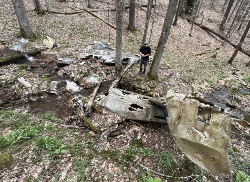
This hike is roughly 5 miles out-and-back to reach the crash site of the USAF C45 from 1960. Remnants of the plane are still at the crash site although the trail is not well marked. I recommend using a GPS and a paper map to reach this site.
But first, a little history…
Information about the crash had been posted at the site by an unknown source. It reads:
“Twin engine C45 en-route from Richmond VA to Lockbourne Air Force Base, OH. Last radio report came into Elkins, WV airport at 5:20pm March 23, 1960 from pilot Capt. William G. Barbour. The aircraft was losing altitude due to icing of the wings about 30 mi. due east of Elkins, WV. 12pm March 24, 1960, search planes spotted burned wreckage in a isolated section of the Monongahela National Forest near the Laurel Fork River. The first rescue teams were unable to reach the crash site by dark due to snow drifts of 10-12′ deep. March 25, 1960, state road crews were able to plow the nearly 16 mi. of forest service roads to access the area, and crews were finally able to reach the wreckage. The charred bodies of four people were found still strapped to their seats. The plane had been gutted by fire shortly after the crash. Rescuers reported only a few treetops sheared off where the plane had come down indicating the plane had went almost straight in when it crashed. The pilot Capt. Barbour was a very experienced aviator having flown 37 combat missions in a B-24 bomber in WWIl.”
“The victims were identified as Capt. William G. Barbour Florence SC, Pilot; Mrs. Elizabeth D. Tucker, Richmond VA Lt. Col Civil Air Patrol; Dr. Monroe Hatch, Sumter SC, Civilian employee from Shaw Air Force Base; Mr. Clarence Bomar, Education Director Civil Air Patrol in North Carolina.”
Directions to the Site
First, drive to Laurel Fork Campground and park at Laurel River Trail Head. There is room for about 3 vehicles beside the outhouse. If you are camping at the campground, it is $8 per night in a single camper lot.
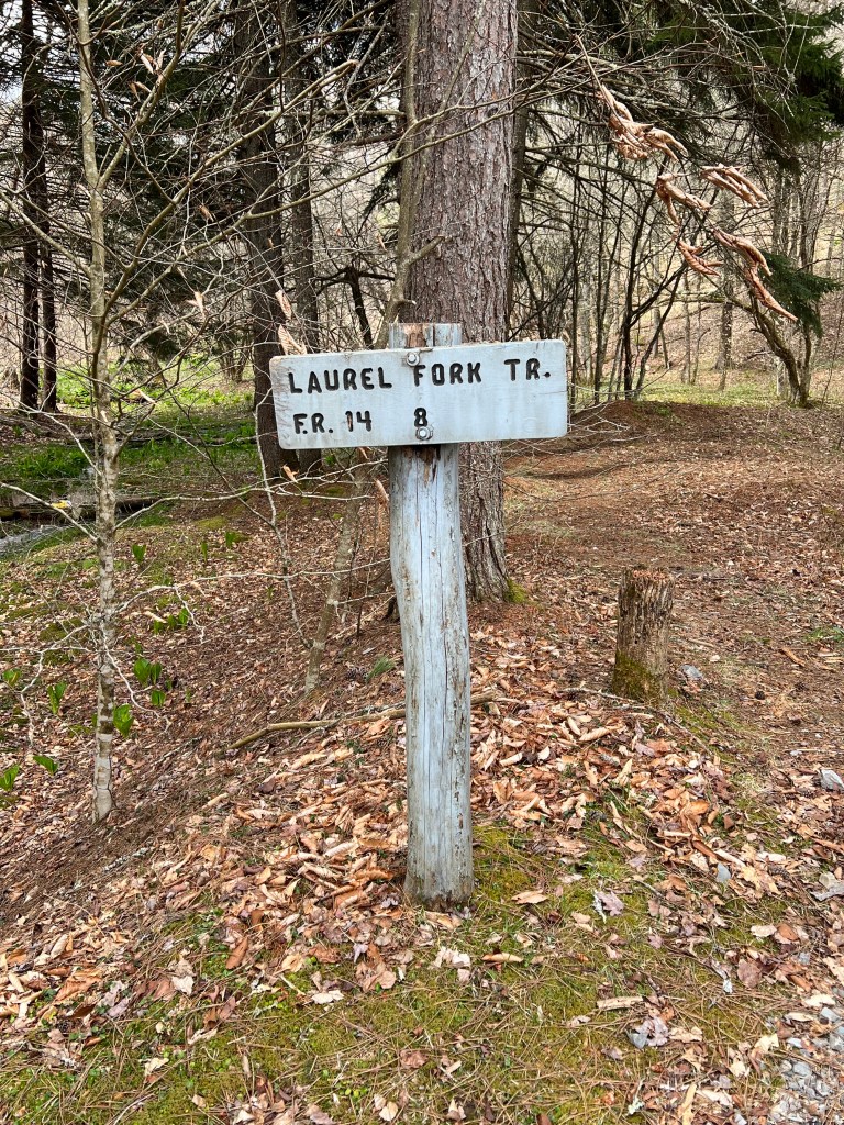
Once at the trail head, hike Laurel River trail (Trail 306) for roughly 2 miles until you reach the intersection of Beulah Trail (Trail 310) coming down the hill on the right.
After passing Beulah Trail (Trail 310), continue about 0.3 miles until you reach the next ravine. At this point, follow the creek up the ravine until you reach the crash site. You may be able to see the crash site debris from the creek depending on seasonal plant growth. When we visited in May, you could easily find the ravine by looking for an abundance of ramps.
An alternate method for hiking to the crash site is hiking down Beulah Trail (Trail 310) from County Road 22/2 and make a right at the intersection with Laurel River Trail (Trail 306). Continue about 0.3 miles until you reach the next ravine. At this point, follow the creek up the ravine until you reach the crash site.
Here’s a video of the hike we took from the Laurel Fork Campground to reach the crash site:
As you can see, the trail is small and not well maintained in some areas. From my understanding, this trail is primarily used by fishermen and we saw many out that day, some of which were familiar with the crash site and were happy to share directions. The trail has no official blaze which makes it easy to become turned around if you are not following GPS locations and/or a map. I always recommend both while hiking, especially in areas you are unfamiliar with and have no cell service.
However, this hike was such an interesting day trip. I completed it with my parents and our 2 dogs and found there was plenty of water for our lab to enjoy along the way. I would recommend this to any history buffs out there or other who have never been to a crash site. Please be sure to refrain from touching or taking any of the debris. Please be respectful of the site and those whose lives it represents.

GPS: 38 °43’22.2″N 79 °42’42.2″W
Ratings:
Kid / Family Friendly: Yes
Pet Friendly: Yes
Solo Friendly: Yes if you have GPS/Maps
Female Friendly: Yes

Leave a comment